As of March, 2025, Tropical Cyclone Alfred is making headlines across Australia, with its sights set on Queensland’s southeast coast, particularly Brisbane. This powerful weather system, currently classified as a Category 2 cyclone, is poised to bring heavy rainfall, destructive winds, and potential flooding to one of Australia’s most populous regions. Here’s everything you need to know about Cyclone Alfred, its impact on Brisbane weather, and what it means for Australia as a whole.
What is Tropical Cyclone Alfred?
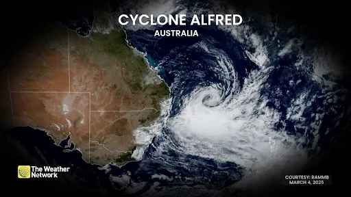
Tropical Cyclone Alfred emerged in the Coral Sea and has been steadily intensifying over the past week. According to the Bureau of Meteorology (BoM), Alfred is expected to make landfall between the Sunshine Coast and Coolangatta, with Brisbane squarely in its path. As of Wednesday morning, the cyclone was approximately 325 kilometers east of Brisbane, moving west-northwest at 14 km/h, packing winds of 95 km/h and gusts up to 130 km/h.
This rare cyclone event—marking the first direct hit on southeast Queensland since 1974—has authorities and residents on high alert. With forecasts predicting up to 800 mm of rain in some areas and wind gusts potentially reaching Category 3 strength, Alfred is shaping up to be a significant weather event for 2025.
Brisbane Weather: What to Expect
Brisbane, a city no stranger to flooding but less accustomed to tropical cyclones, is bracing for impact. The BoM has warned that Alfred could cross the coast early Friday morning, possibly coinciding with a high tide—a worst-case scenario that could amplify storm surges and coastal erosion. Here’s a breakdown of what Brisbane residents can anticipate:
- Heavy Rainfall: Rainfall totals could range from 300 mm to 600 mm over multiple days, with isolated areas seeing even higher amounts. Flash flooding is a major concern, especially in low-lying suburbs like Nudgee Beach, Brighton, and Rocklea.
- Damaging Winds: Gusts of 60–80 mph (97–129 km/h) are expected, with the strongest winds likely south of the cyclone’s eye, impacting areas like the Gold Coast and northern New South Wales.
- Storm Surge and Erosion: Waves exceeding 7 meters have already been recorded off North Stradbroke Island, and coastal inundation could threaten canal estates and beachfront properties.
The city has already distributed over 400,000 sandbags, and evacuation centers are being set up, including a cyclone-rated refuge at the RNA Showgrounds in Bowen Hills. Schools, airports, and public transport are shutting down as the region prepares for the storm’s arrival.
Cyclone Alfred’s Broader Impact on Australia
While Brisbane is at the epicenter of this cyclone, its effects will ripple across southeast Queensland and northern New South Wales. The warning zone stretches from Double Island Point to Grafton, encompassing over 4 million people. Communities like the Sunshine Coast, Gold Coast, Byron Bay, and Ballina are also in the firing line, with authorities warning of a “one-in-35-year event” for some areas.
Queensland Premier David Crisafulli has emphasized the cyclone’s three-phase threat: coastal erosion from massive swells (already reaching 15 meters in Wide Bay), damaging winds, and widespread flooding. Northern NSW Premier Chris Minns has mobilized 40 rescue teams to prepare for potential flood disasters in the Northern Rivers region, an area still recovering from devastating floods in recent years.
Preparing for Cyclone Alfred in Brisbane
For Brisbane residents and those in affected areas, preparation is critical. Here are some key steps to stay safe:
- Secure Your Property: Clear yards of loose items, trim overhanging branches, and sandbag vulnerable areas.
- Stock Up: Ensure you have food, water, batteries, and a radio for at least three days.
- Stay Informed: Monitor updates from the BoM and local authorities via their websites or ABC Radio.
- Evacuation Plans: Know your nearest evacuation center and consider relocating if you’re in a flood-prone or coastal area.
The Brisbane City Council and Queensland Government have urged residents to act now, as conditions will deteriorate rapidly by Thursday afternoon, making last-minute preparations difficult.
Why Is This Cyclone Unusual?
Tropical cyclones typically strike northern Australia, not the subtropical southeast. Alfred’s path is being steered by a high-pressure system over the Tasman Sea, pushing it westward into an area unaccustomed to such storms. Warmer-than-average sea temperatures and La Niña conditions are fueling its intensity, raising concerns about climate change’s role in shifting weather patterns. Experts note that while cyclones have hit Brisbane before (e.g., Cyclone Wanda in 1974), the region’s population boom and infrastructure development since then heighten the stakes.
Looking Ahead
As Tropical Cyclone Alfred approaches, the focus remains on safety and preparedness. The storm’s slow movement means prolonged impacts, with heavy rain and thunderstorms possible into the weekend even after landfall. For Brisbane and beyond, this cyclone is a stark reminder of nature’s power and the importance of resilience in the face of extreme weather.
Stay tuned for updates as Alfred nears the coast, and keep safe, Australia!